Earthworks in your browser
Cut and fill, site levels and mass haul, from the survey to the bill. Bring in survey points, a DXF, LandXML, Environment Agency LIDAR, a drone point cloud or a PDF drawing; draw platforms, pads, roads, car parks, ponds and trenches with batters that meet the ground; and get exact volumes to formation, the balance after bulking and shrinkage, the haul plan, monthly valuations and a priced bill. No install, nothing uploaded, on Windows or Mac.
Survey points (CSV), DXF with a role for each layer, LandXML, Environment Agency LIDAR (ASC, GeoTIFF) and drone point clouds (LAS), triangulated with breaklines kept.
Place a PDF at its scale, snap to its line work, and read its spot levels off the page in one go, each on its survey cross.
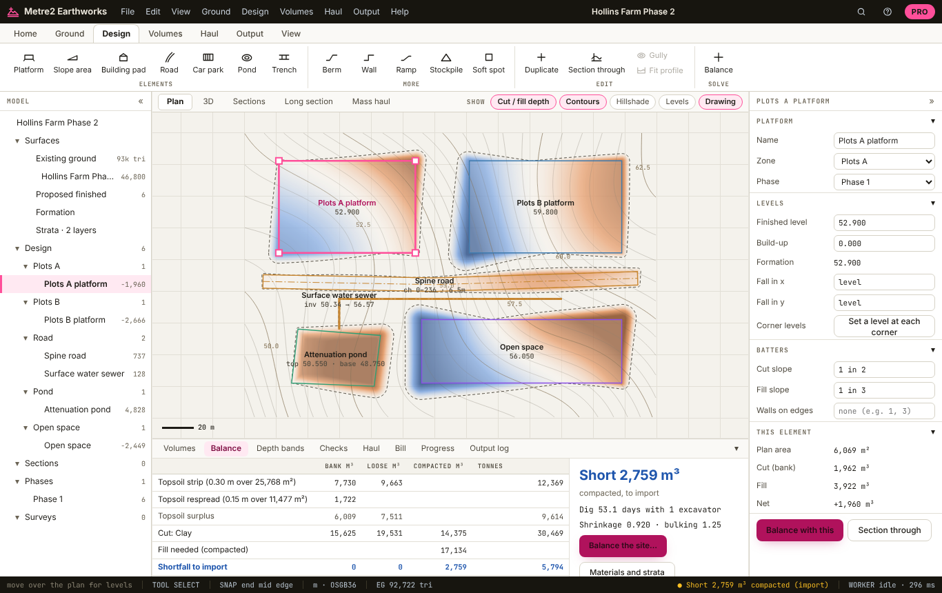
Draw a platform, type its level and falls: batters run out to meet the ground at your cut and fill slopes, fanned round corners. Free for up to 5.
Every design triangle overlaid on the ground and the depth integrated exactly, with a heat map of cut and fill and the levels at the cursor.
Draw a section anywhere: ground, finished level, formation and topsoil, with cut and fill shaded and their areas, at any exaggeration.
The ground and the design in 3D, coloured by cut and fill depth, with vertical exaggeration.
Strip before the dig and respread on batters and landscaping, with the surplus, and the bulk volumes measured from the stripped level.
A one-page volumes summary with the plan, with no watermark. Surveys and drawings are read on your computer; no account is needed for the free version.
Three sample sites come with it, each with its ground made in your browser: a housing phase on LIDAR, a warehouse pad with a service yard, and a sports pitch.
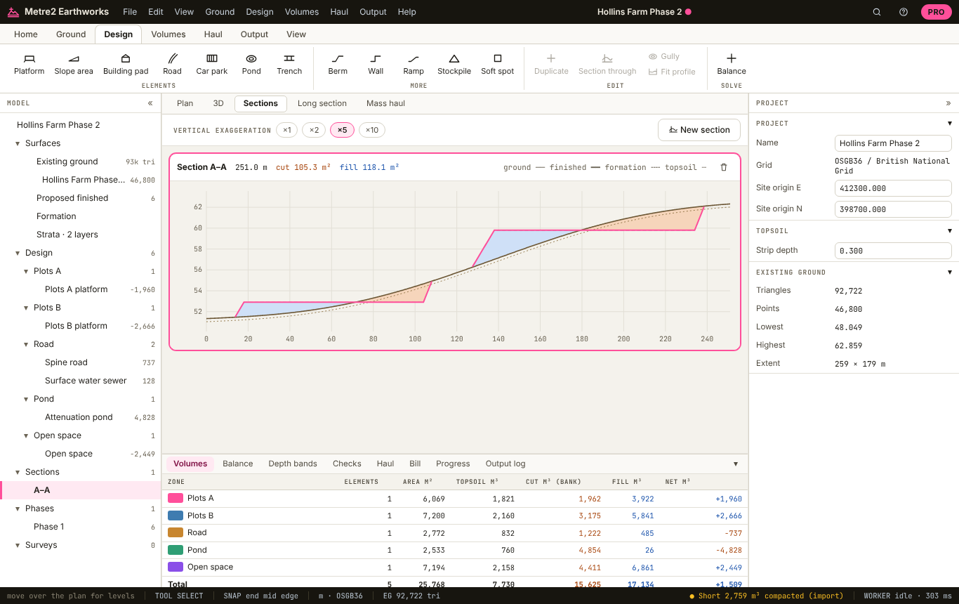
Sections, cut and fill shaded
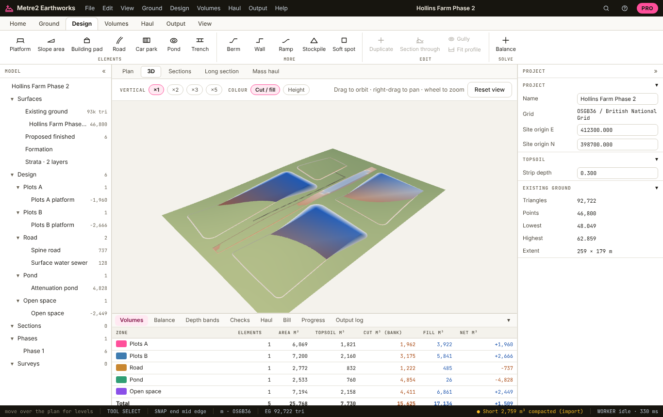
The site in 3D
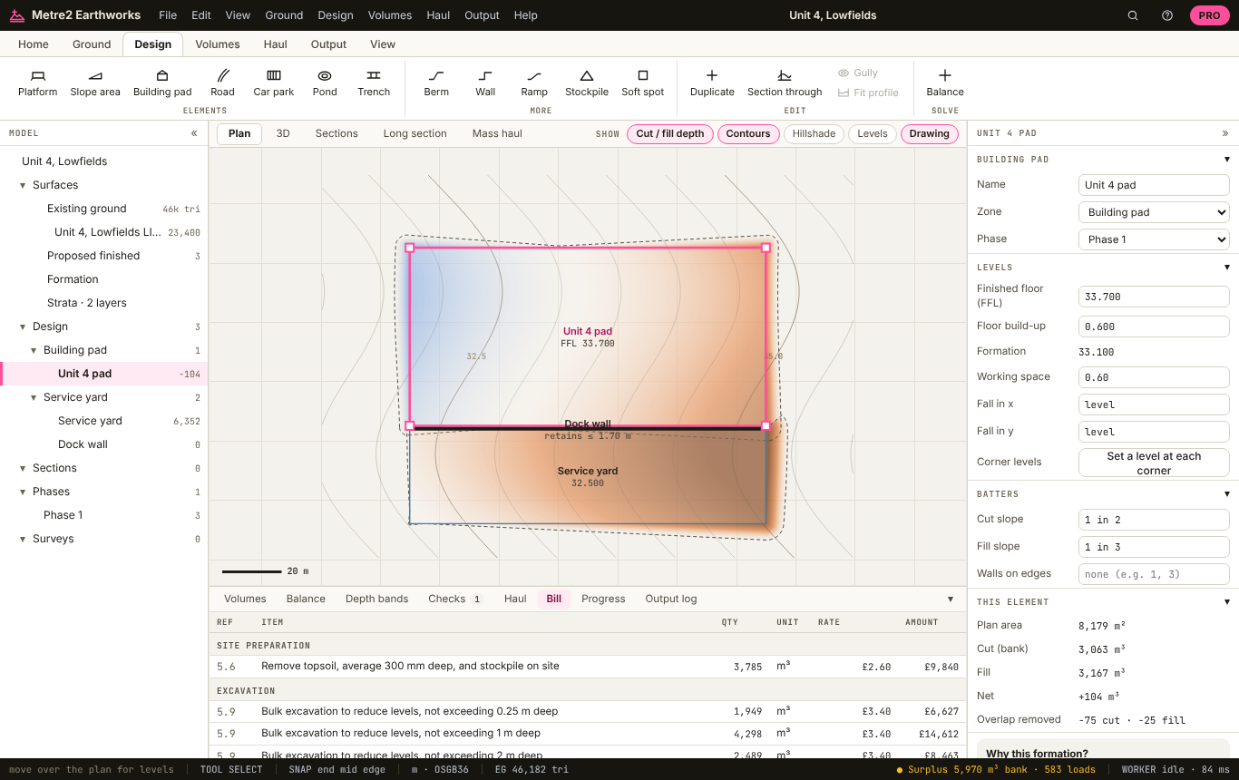
A building pad and the priced bill
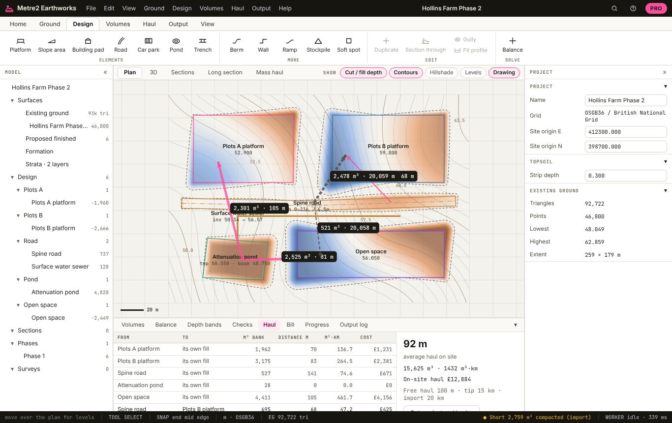
The site-wide haul plan
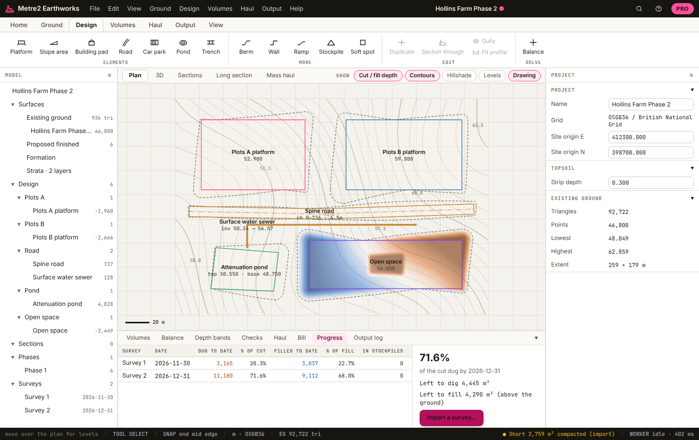
Progress surveys and valuations
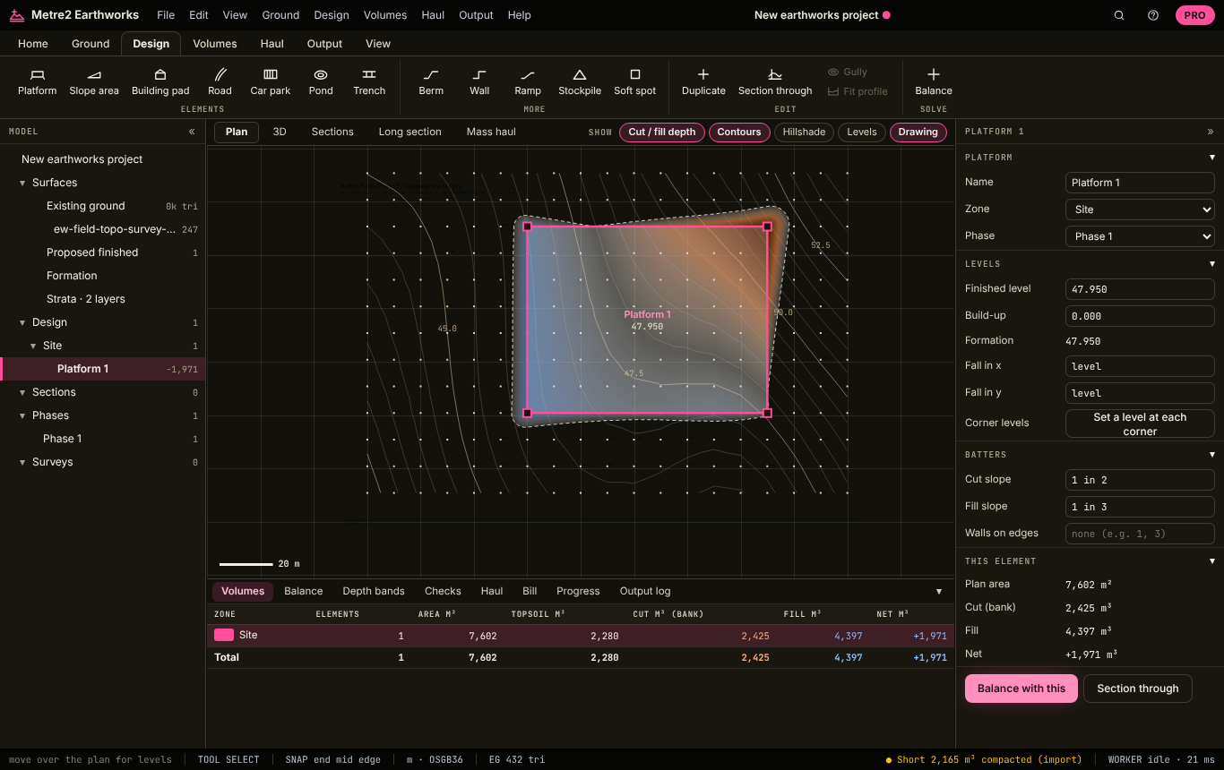
PDF tracing, in site-at-night mode
Ground from any source, 5 platforms, cut and fill, 3D and sections stay free. Earthworks Pro is a subscription for groundworkers, estimators, QSs and site engineers who price and run earthworks: £19.99 a month or £179 a year with a free Metre2 account, and the first 7 days free.
Building pads with floor build-up and working space, car parks with falls and gullies, ramps, ponds, trenches, bunds, retaining walls, stockpiles and soft spots, resolved where they overlap.
Centre line, carriageway, verges, crossfall or camber, a vertical profile with curves and pavement build-up, with the long section.
Layers from boreholes and trial pits, with bulking, shrinkage, density, reuse and waste class, and the cut split by material.
The balance in bank, loose, compacted and tonnes, and an optimiser that raises or lowers your platforms to balance or leave a set surplus.
Brückner diagrams with balance points and overhaul, and the least-cost haul from every cut to every fill, with the tip and imports.
Dated drone or GPS surveys: dug and filled to date, this month priced at your rates, stockpiles measured, and what is left.
An earthworks bill in the shape of NRM2 work section 5: excavation by depth band, disposal with landfill tax, filling, haulage and OH&P, to Excel with live formulas.
The full report, A3 and A1 cut and fill drawings with isopachs and a title block, LandXML for Trimble, Leica and Topcon, DXF, IFC and setting-out.
| FEATURE | FREE | PRO £19.99/MO |
|---|---|---|
| Ground from survey points, DXF, LandXML, LIDAR, drone point clouds or a traced PDF | Yes | Yes |
| Platforms and slope areas with batters | Up to 5 | Any number |
| Exact cut and fill, heat map, sections and 3D | Yes | Yes |
| Topsoil strip and respread | One depth | Yes, by area |
| One-page summary PDF, no watermark | Yes | Yes |
| Building pads, car parks, roads, ramps, ponds, trenches, bunds, walls and stockpiles | No | Yes |
| Strata, bulking, shrinkage and materials | No | Yes |
| Balance optimiser | No | Yes |
| Mass haul diagrams and the haul plan | No | Yes |
| Progress surveys and valuations | No | Yes |
| Priced bill (NRM2 shape) to Excel | No | Yes |
| Full report, A3 and A1 drawings | No | Yes |
| LandXML, DXF, IFC and setting-out exports | No | Yes |
Yes, for the everyday sums: the existing ground from any source, PDF tracing, up to 5 platforms or slope areas, cut and fill with the heat map, 3D, sections, topsoil strip at one depth and a one-page summary PDF with no watermark. Earthworks Pro, £19.99 a month or £179 a year with a 7-day free trial, adds every other design element, strata and materials, the balance optimiser, mass haul and the haul plan, progress surveys and valuations, the priced bill, drawings, the full report and machine-control exports.
Exactly, from the two surfaces: every design triangle is overlaid on every ground triangle under it, and the depth between them is integrated on each piece, split where it changes from cut to fill. The report shows the grid and end-area methods beside it as a check. How it is tested.
Yes. Download the free 1 m DTM tile for your site as GeoTIFF or ASC and drop it on the window; tiles merge, and big ones are resampled to stay quick.
Yes. Pads, car parks and roads have a build-up, and the volumes are to formation, the finished level less the build-up, widened by any working space. The bulk dig is measured from the stripped level, below the topsoil.
Yes, in Pro: each material has a bulking factor (loose / bank), a shrinkage factor (compacted / bank), a density and a use, so the balance is in bank, loose, compacted and tonnes.
Yes, in Pro: LandXML of the composite finished or formation surface merged with the ground, read by Trimble, Leica and Topcon, plus DXF, IFC and a setting-out CSV.
For earthworks takeoff from PDFs, surveys and LIDAR with platforms, roads, trenches, sections and machine-control export, yes, in a browser on Windows or Mac, with strata, mass haul, valuations and a priced NRM2-shaped bill in the same tool. Compared with Kubla Cubed.
No. Earthworks runs in your browser: survey files, LIDAR tiles and drawings are read on your computer, and your project is kept in this browser until you save it as a .m2earth file.
Not for the free version. Earthworks Pro and its 7-day trial use a free Metre2 account, so your subscription works in any browser where you sign in.
Step by step, recorded in Earthworks itself, with the real numbers from each site. Also: the help manual, how it is tested, and how it compares with Kubla Cubed and a spreadsheet.
Each one opens in the app with its ground made on the spot, so you can look around before you bring in your own survey. The Pro sample can be explored freely; its Pro elements and exports need Pro or its 7-day free trial.
How to use it, how we check the volumes against hand calculations, and how it compares with the tools most estimators know.