How-to guide
Cut and fill is the earth dug out where a level platform sits below the ground, and the earth brought in where it sits above. To work it out you need two surfaces, the existing ground and the design, and the volume between them. This guide brings in a LIDAR tile of a sloping field, draws a 110 x 70 m platform at 48.20 m and reads the volumes in Metre2 Earthworks: 4,668 m³ of cut and 6,778 m³ of fill, worked out exactly from the two surfaces, free in your browser.
On the Ground tab choose LIDAR (an ASC or GeoTIFF tile), Points (a CSV of easting, northing, level), DXF, LandXML or a Point cloud (LAS). Earthworks triangulates it into the existing-ground surface. The tile here is 240 x 170 m at 1 m: 80,782 triangles.
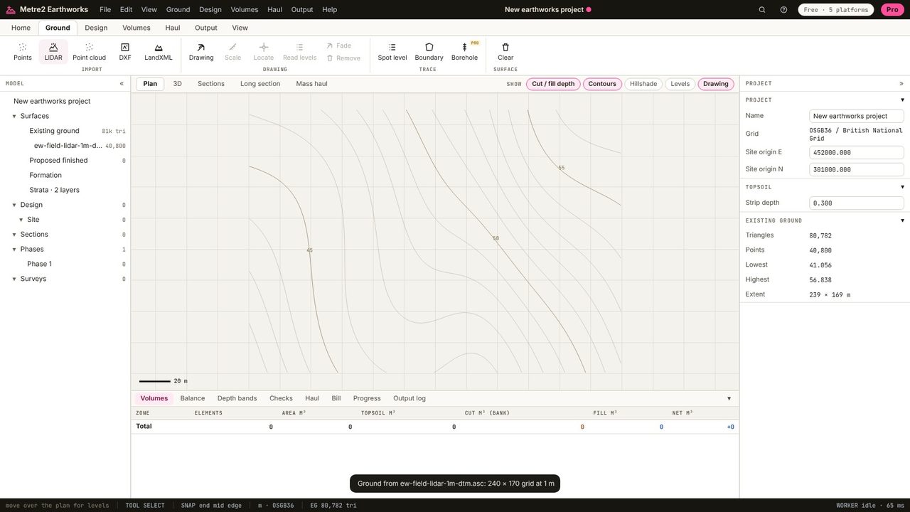
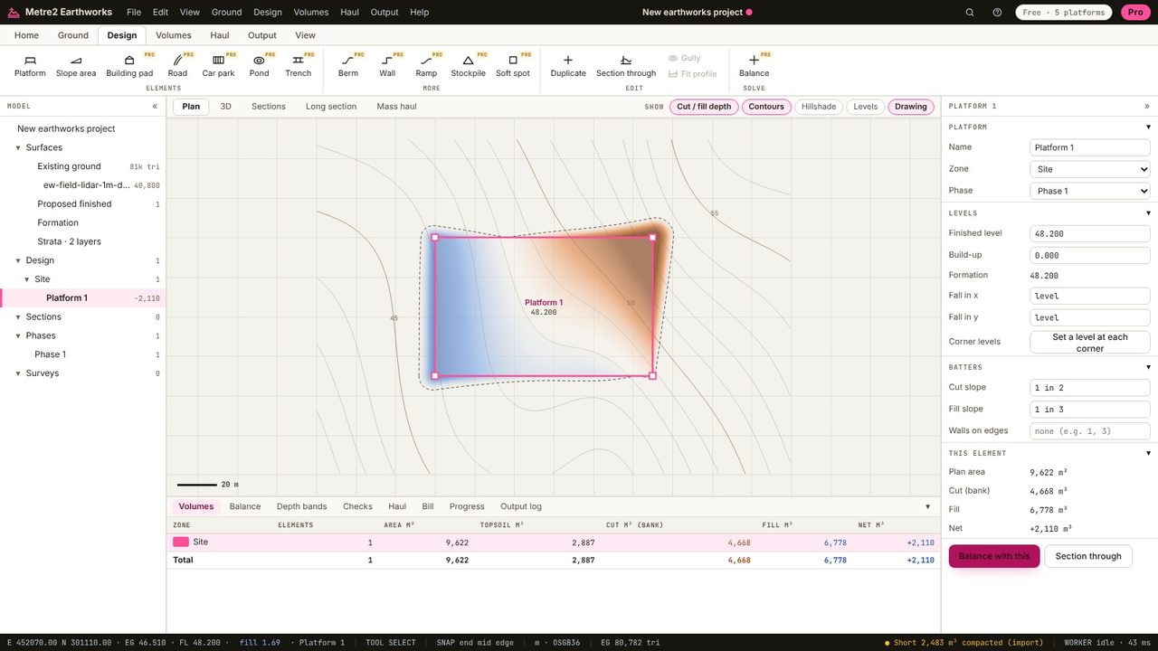
On the Design tab choose Platform and click its corners on the plan; click the first corner again or press Enter to finish. Earthworks gives it a first level from the ground under it and runs batters out from every edge, at 1 in 2 in cut and 1 in 3 in fill, until they meet the ground. The dashed line is where they meet (the toe or top of batter).
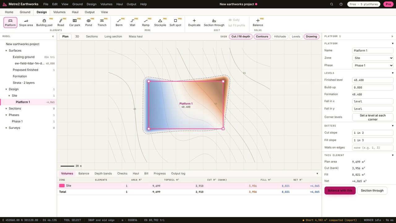
Type the level in Properties: 48.20 m here. Falls in X and Y (1 in 80, 1.25%) tilt it; the batter slopes are below. The volumes update as you type.
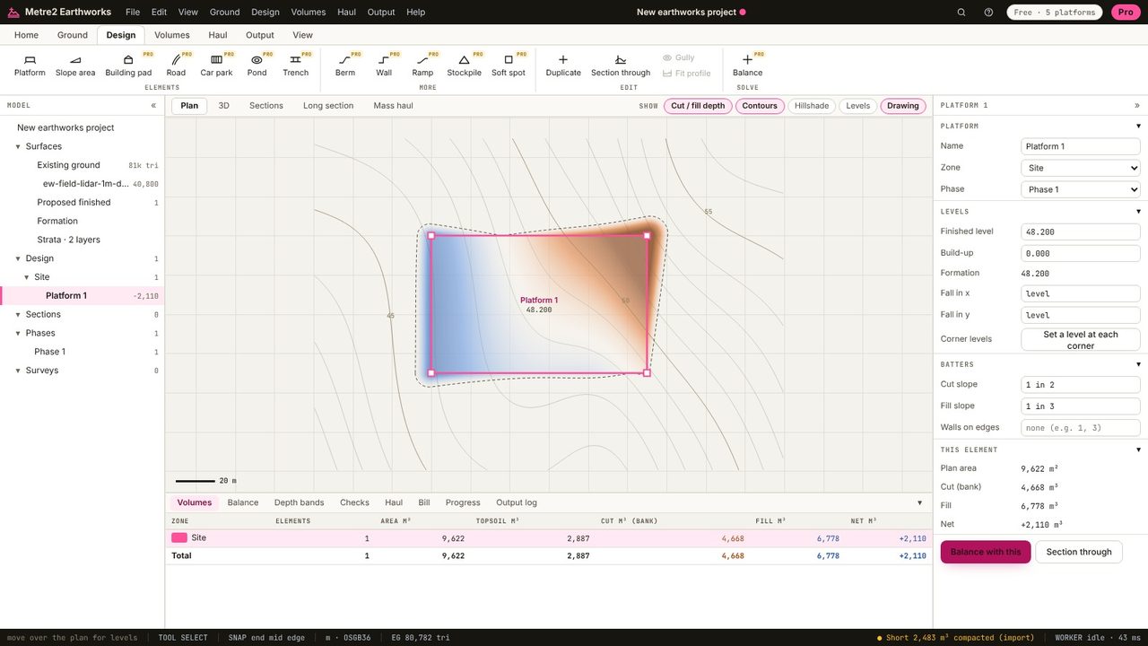
The Volumes tab gives cut and fill by zone and in total: 4,668 m³ of cut and 6,778 m³ of fill over 9,622 m², batters included. Cut is in bank m³ (as dug), measured below the topsoil strip.
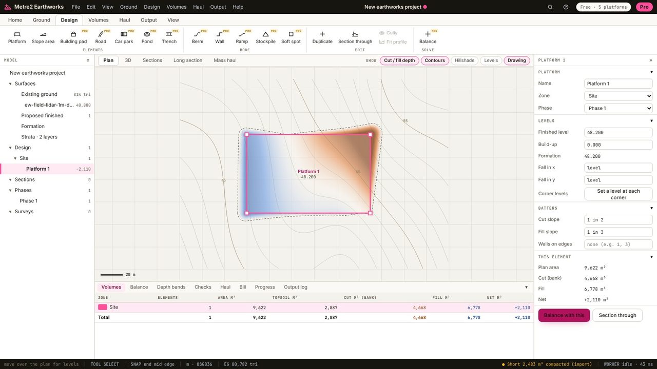
The plan is coloured by depth to formation: burnt orange for cut, blue for fill, paler near the line where cut turns to fill. Move over the plan and the status bar gives the ground level, the design level and the cut or fill at the cursor.
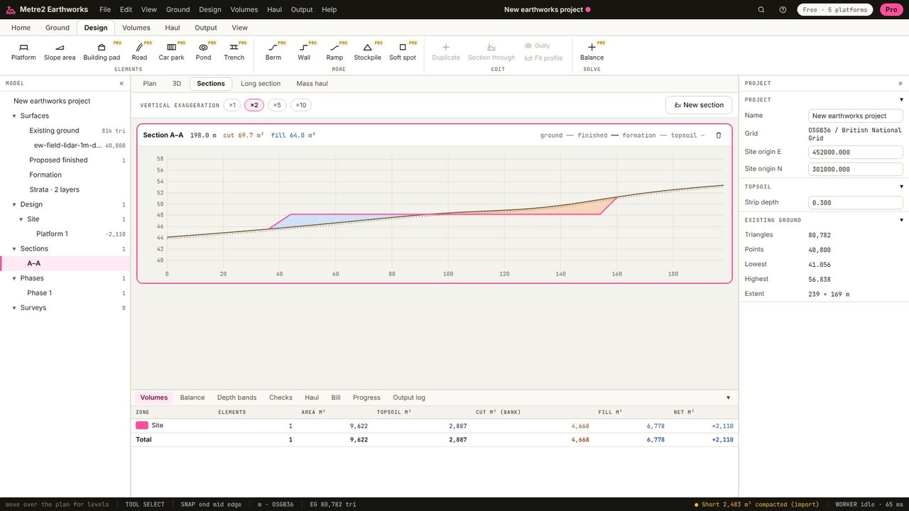
Section through cuts a cross-section across the platform: the existing ground, the finished level and the batters, with the cut and fill shaded and their areas.
Take the existing ground and the design as two surfaces and integrate the depth between them: where the design is below the ground it's cut, where it's above it's fill. Earthworks does this exactly from the two triangulated surfaces, and also shows the grid and end-area methods as a check.
Not quite. Dug material bulks up when loose and compacts when placed, so 1 m³ of cut doesn't make 1 m³ of fill. The balance uses shrinkage factors: see bulking and shrinkage.
Yes: ground from any source, up to 5 platforms or slope areas, the cut and fill and heat map, 3D, sections and a one-page summary PDF with no watermark.
No. Earthworks runs in your browser: survey files, LIDAR tiles and PDF drawings are read on your computer and the project is kept in your browser until you save it as a file.