A personal world map, studded with your own pins

Metre2 Pin Collection Atlas

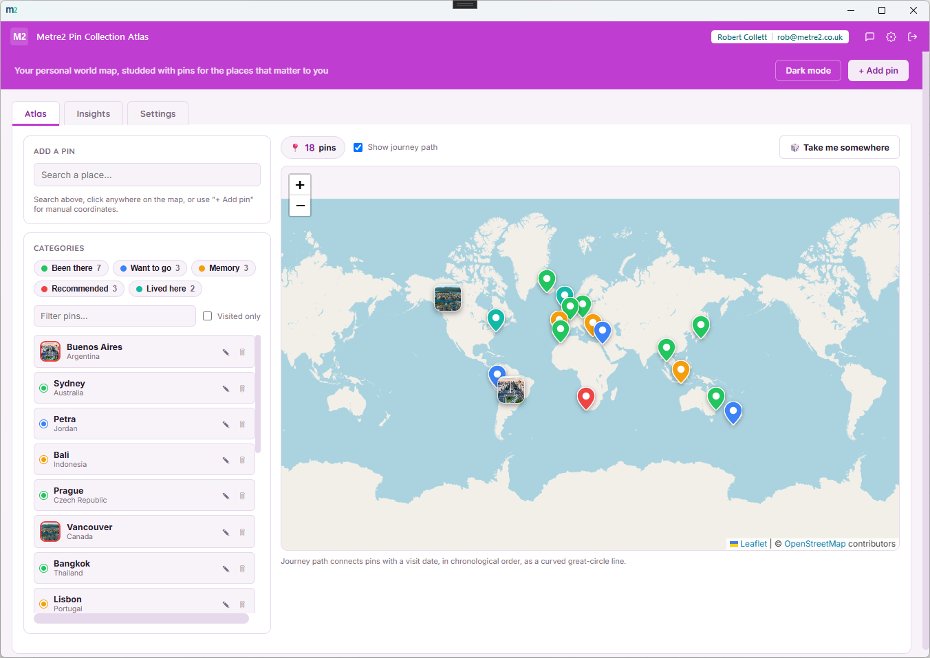
Drop pins on a real world map for the places you've been, want to go, or want to remember - each with a note and an optional photo. Turn on the journey path and every place you've visited connects with a curved, animated line that traces the real great-circle route across the globe.

Metre2 Pin Collection Atlas Atlas tab showing a categorised pin list on the left, a real world map with coloured teardrop pins on the right, and an animated curved journey path connecting visited pins

Real map, real place search

Search any address or place name to drop a pin with Nominatim geocoding, or click straight on the map (Leaflet with OpenStreetMap tiles) - no need to know coordinates.

Animated great-circle journey path

Turn on "Show journey path" and every visited pin connects with a curved, marching-ants animated line drawn using real great-circle geometry - the true shortest curved path over a globe, not a naive straight line through the earth.

A photo and a note on every pin

Attach one photo per pin - automatically resized and compressed in your browser before it's stored - plus a note up to 500 characters. Click a photo to view it full-size in a lightbox.

Six pin categories, colour-coded

Favourite, memory, visited, want to go, recommend, or other - each its own colour on the map and in the legend, so your whole collection reads at a glance without opening a single pin.

Insights with animated stats

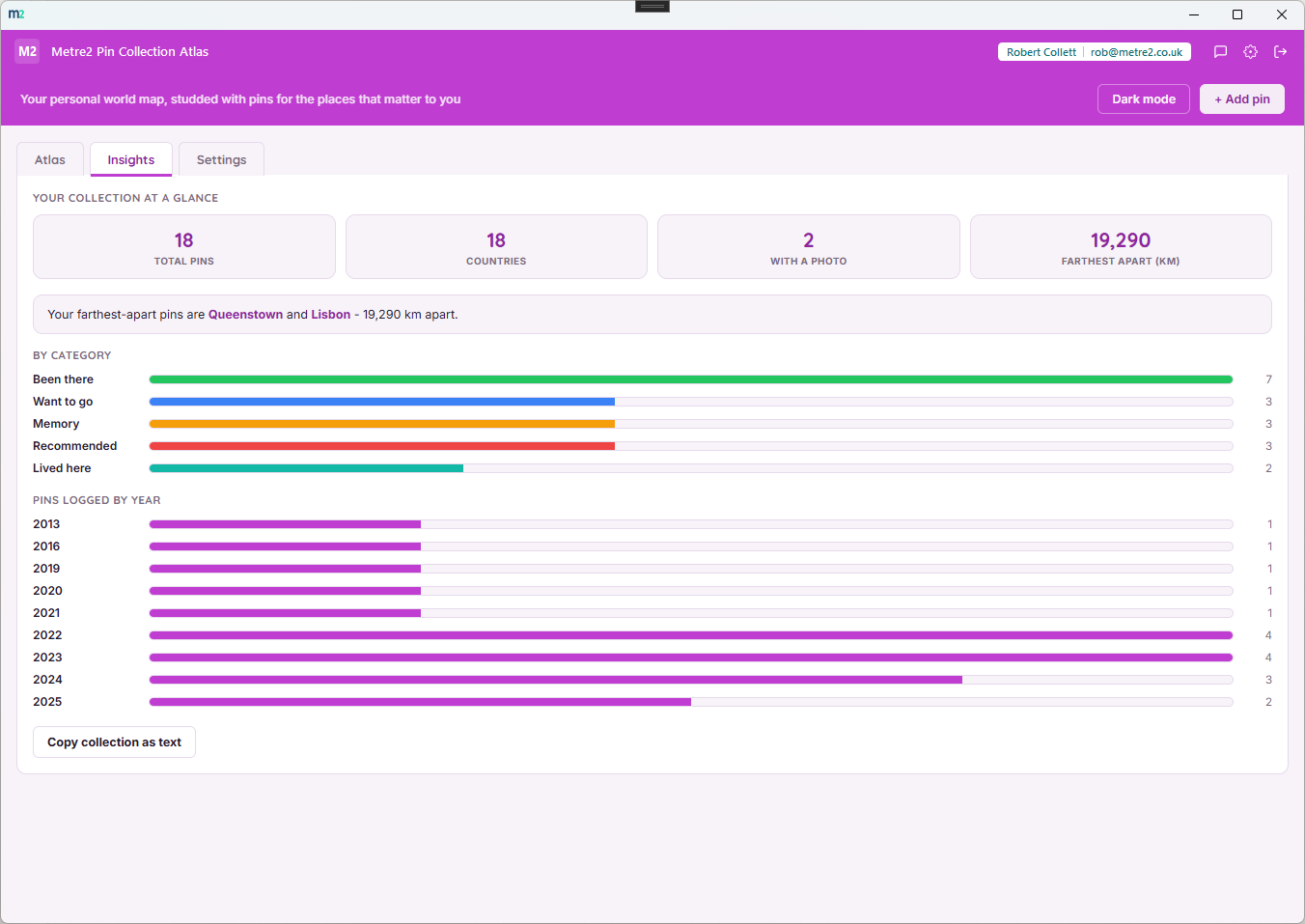
Farthest and nearest pin pairs, a bounding box and centre point, counts by category and by year, and a "Copy collection as text" button - presented with animated count-up stat cards, not a flat table.

Milestone celebrations

Hit 10, 25, 50 or 100 pins and a short on-screen confetti burst marks the moment - a small, optional flourish that doesn't touch your data.

"Take me somewhere" surprise button

Not sure where to look next? One click flies the map to a random pin from your own collection - a small nudge to revisit somewhere you'd forgotten you'd marked.

Your pins stay on your device

Every pin, note and photo is stored locally in your browser storage, not on a server. Only map tiles and place search go out over the internet - your collection is never uploaded anywhere.

Not a single-trip planner

Distinct from a route planner: this is a permanent, growing collection you add to for years - favourite restaurants, childhood homes, memories, recommendations - not an ordered plan for one upcoming trip.
How it compares to a paper map, Google's saved places, or a trip planner

Most people either keep a mental list, star places in Google Maps, or use a photo album. Here's how a dedicated personal pin atlas compares.

Feature Pin Collection Atlas Google Maps saved places A single-trip route planner
Pricing model Free Free Varies
Photo and note on every place (labels only)
Animated journey path between visited places (real great-circle arcs) (driving routes only)
Built for a permanent, growing collection (one trip at a time)
Insights: farthest/nearest pin, counts by category and year
Your data stays on your device (synced to your Google account) Varies

General comparison as of August 2026. Not affiliated with Google Maps.

Pin Collection Atlas, in practice

Frequently asked questions

Is this a trip planner like Road Trip Route Studio?

No. Road Trip Route Studio plans an ordered, driveable route for a single upcoming trip. Pin Collection Atlas is a permanent, categorised, photo-and-note-annotated personal collection of places - favourite spots, memories, recommendations, places you want to go - that you add to over years, not a single journey you're about to drive.

What is the animated journey path?

Turn on "Show journey path" and every pin you've marked visited is connected by a curved, animated dashed line drawn using real great-circle geometry (the actual shortest curved path over a globe), not a straight line - so a route from London to Tokyo arcs realistically over the northern hemisphere instead of cutting through the Pacific.

Can I add a photo to a pin?

Yes - each pin can carry one photo, automatically resized and compressed in your browser before it's stored, plus a note up to 500 characters. Click a pin's photo to view it full-size in a lightbox.

Does it use a real map, and does that cost anything?

Yes. The map is Leaflet with OpenStreetMap tiles, and place search uses the free Nominatim geocoder - the same free, public map services used across Metre2's other map-based apps. The app itself is free.

Where is my pin data stored?

Every pin, note and photo is stored locally on your device only. Only map tiles and place search go out over the internet - your pins, notes and photos are never uploaded anywhere.

What are the milestone celebrations?

Hit 10, 25, 50 or 100 pins and the app marks it with a short on-screen confetti celebration - a small, optional flourish, not something that affects your data.

Ready to try Pin Collection Atlas?