A mountain-silhouette elevation chart for any route
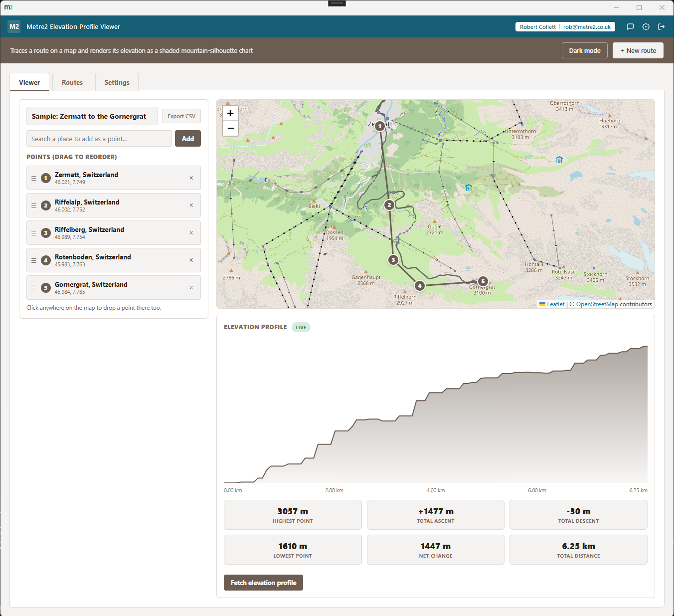
Trace a route on a real OpenStreetMap map - search or click to add points, drag them into order - and see its elevation as a shaded mountain-silhouette chart, with distance markers and gain/loss stats pulled live from the free Open-Elevation API.
A second Viewer route up Snowdon, the Routes tab's saved-route cards, and the Settings tab's units and data-source disclaimer.
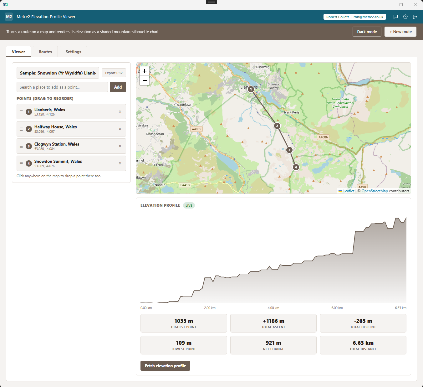
Viewer - a Snowdon (Yr Wyddfa) route, same map-and-chart layout
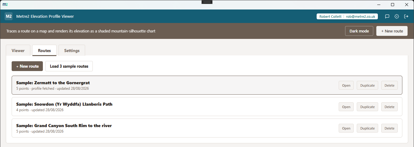
Routes - saved routes as cards, each with its own elevation thumbnail
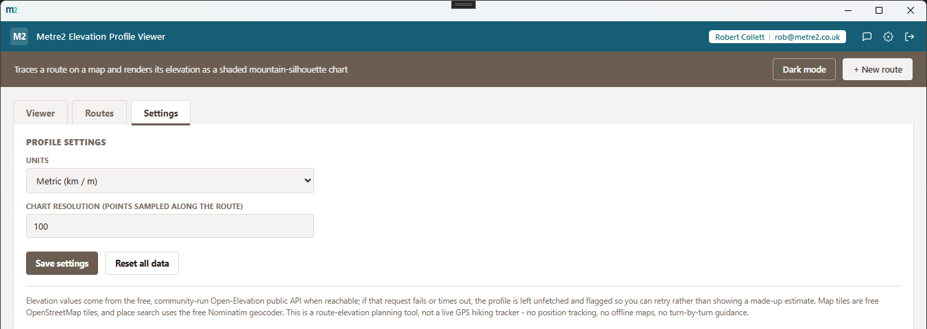
Settings - units, theme, and an honest note about the free data sources
Search any address or place name to drop a point with Nominatim geocoding, or click straight on the map (Leaflet with OpenStreetMap tiles) - no need to know coordinates.
Every point along your route is queried against the free Open-Elevation public API. There's no offline fallback - if it can't be reached, the app shows a clear error rather than a made-up estimate.
The elevation profile renders as a filled area chart with distance markers along the bottom, so you can see exactly where the climbs and descents fall along the route.
A stat strip shows total distance, total elevation gain, total elevation loss, and the route's highest and lowest points - no scrolling through raw numbers to work it out yourself.
Drag any point up or down the list to change the route order - the map, chart and stats all recalculate immediately, including a fresh elevation fetch.
Keep more than one route and switch between them from a Routes tab, each shown as a card with its own mini elevation thumbnail - duplicate a route to try a variation without losing the original.
Choose kilometres and metres or miles and feet, and switch between a light or dark theme that remembers your choice.
Every route persists in local storage, not on a server. Only map tiles, place search and elevation lookups go out over the internet - your saved routes are never uploaded anywhere.
No GPS tracking, offline maps or turn-by-turn guidance - this is for seeing what a route's climbs and descents look like, before you go or after you're back.
Most people either dig through a fitness app's activity history for a past route's elevation, or draw one out by hand before a trip. Here's how a dedicated elevation profile viewer compares.
| Feature | Elevation Profile Viewer | A fitness/GPS app | Drawing it out by hand |
|---|---|---|---|
| Pricing model | Free | Free, often with paid tiers for extra data | Free |
| Plan a route before you've walked it | ✓ | ✕ (usually built from a recorded activity) | ✓ (roughly) |
| Real elevation data, not a guess | ✓ (Open-Elevation) | ✓ | ✕ |
| Save and switch between multiple routes | ✓ | ✓ | ✕ |
| No account, no GPS tracking required | ✓ | ✕ (usually needs an account and a recorded track) | ✓ |
General comparison as of August 2026. Not affiliated with Open-Elevation, OpenStreetMap or any fitness tracking service.
No - use it straight from your browser, on a phone, tablet or PC, with no sign-up. It works offline once it has loaded, and you can add it to your home screen or desktop like an app. There is also a Windows desktop version in the Microsoft Store if you prefer an installed app.
No. The browser edition needs no account at all. Neither does the Windows app - install it free from the Microsoft Store and start, no sign-in.
The map is Leaflet with OpenStreetMap tiles, place search uses the free Nominatim geocoder, and elevation for every point along your route comes from the free Open-Elevation public API. Unlike the driving-distance fallback in some of our other apps, there's no sensible offline estimate for elevation - if Open-Elevation can't be reached, the app shows a clear error instead of guessing.
No. There's no GPS tracking, no offline maps and no turn-by-turn guidance - it's a planning and reference tool for seeing what a route's climbs and descents look like before you go, or for reviewing one afterwards.
Search a place name or click on the map to add a point, then drag points up or down the list to reorder them. Add as many points as you like - the elevation profile and stats refresh whenever the route changes.
Total distance, total elevation gain, total elevation loss, and the highest and lowest points on the route, alongside a shaded mountain-silhouette chart with distance markers along the bottom.
The app is free, and it runs on OpenStreetMap tiles plus the free Open-Elevation and Nominatim public services, which have no per-user cost for reasonable personal use.
Every route you save persists on your device via local storage. Only map tiles, place search and elevation lookups go out over the internet - your saved routes themselves are never uploaded anywhere.